Drones and Farming: The Power Duo of Modern Agriculture
For years, drones in agriculture were seen as optional. Useful, interesting, but not essential. That view has changed. Today, drones and farming are connected at the hip.
DJI estimates roughly 400,000 agricultural drones are now in active use worldwide, across more than 100 countries and 300 crop types. In the United States, 75% of current agro users plan to expand their fleets, and a majority of non-users expect to adopt.
The surge in interest came from ongoing pressures. Labor shortages have turned routine fieldwork into a constraint. Input costs continue to rise. Weather variability shortens decision windows. Spotting problems late now has real financial consequences.
Drones can help (and already do) address these operational problems effectively, as the following cases illustrate.
Seeing Crop Stress Before it Becomes Yield Loss
Crop health monitoring is where drones deliver the clearest return. Instead of doing intensive manual field walks or delayed satellite passes, farmers can run short scouting flights to scan the entire field in minutes.
A helicopter view gives richer insights into crop wellbeing. RGB imagery can convey the following insights:
- Early signs of nutrient stress
- Disease pressure
- Soil compaction
- Irrigation imbalance
On top, multispectral sensors and indices like NDVI can provide even richer insights to quantify plant vigor and chlorophyll activity. So that scouting moves from observation to measurement.
With preventive data, you can cut down on chemical use and apply targeted treatments, so that crop quality and yield rise without as much cost pressure. Take it from Sunnyvale Orchards, a 500-acre specialty fruit operation.
By combining drone-based monitoring with targeted application, the farm cut pesticide use by 35 percent, reduced water consumption by 40 percent, and improved crop quality by 15 percent. Given the value of the crop, the system paid for itself in under a year.
Optimizing Irrigation and Water Use
Water management is another great example of drones and farming synergy in action.
Many irrigation problems are hard to diagnose from the ground. Overwatered zones, dry patches, runoff paths, and drainage failures often stay invisible until crops show stress.
Aerial data removes that blind spot. Drone flights reveal how water actually moves through a field. Dry areas sit next to saturated ones. Runoff paths become traceable. When paired with GIS tools and basic hydrological models, this shifts irrigation from reactive fixes to informed planning.
The value is most evident in water-constrained environments. In Sidi Bouzid, researchers used drones to support olive cultivation under severe water scarcity. Drone imagery combined with GIS-based watershed analysis exposed drainage patterns, erosion risks, and zones under water stress. The results showed significant variation between plots, enabling precision irrigation recommendations aligned with local hydrology.
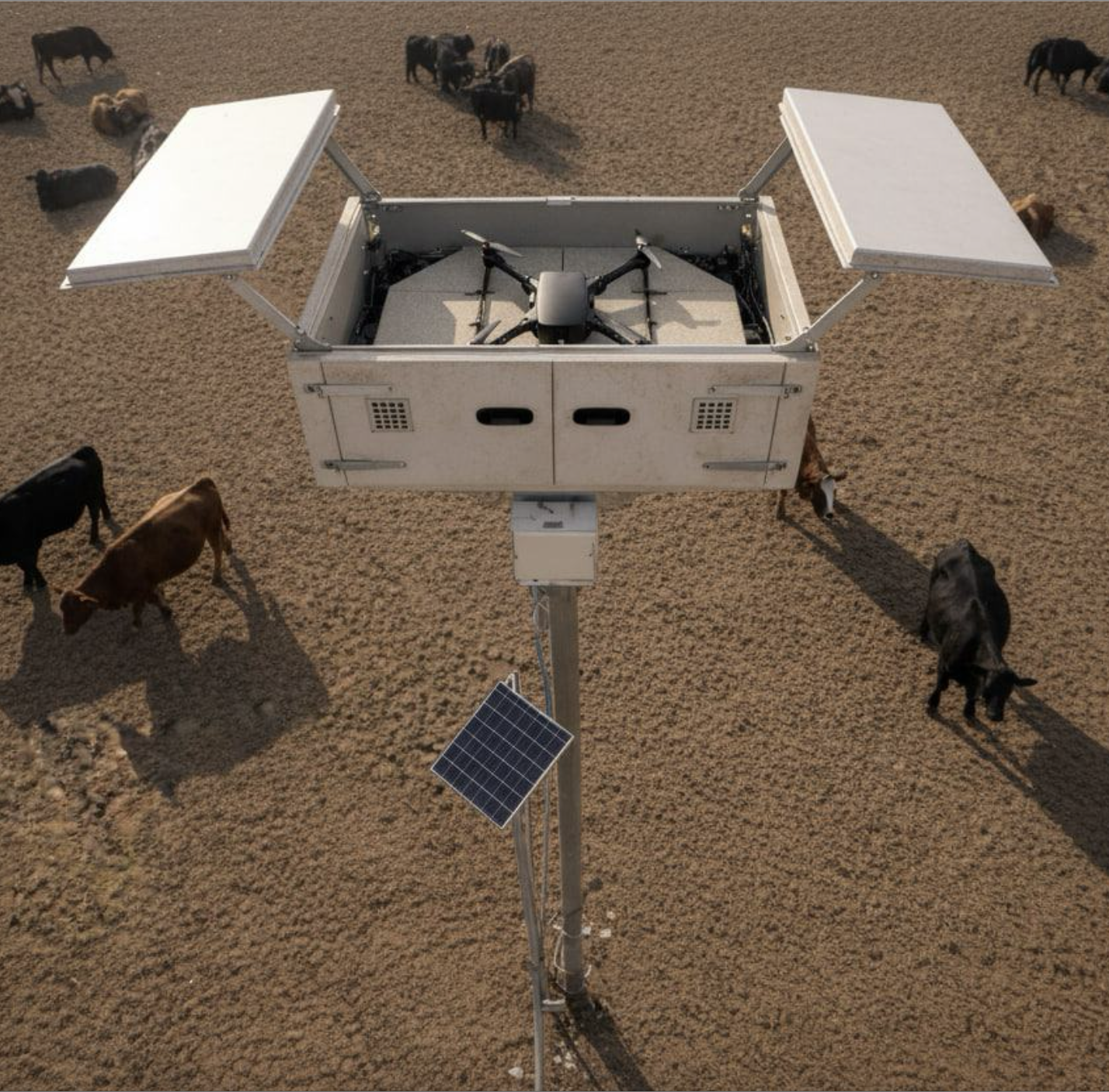
Managing Livestock Without Walking Every Hectare
Livestock operations face a different constraint: scale. Land is vast, often remote, and slow to inspect. Locating animals, checking fences, and verifying water access can consume hours before any corrective work even starts.
Drones compress that effort. A single flight can survey large grazing areas, locate herds, and flag infrastructure issues without disturbing animals. The value isn’t novelty. It’s time to recuperate and have fewer blind spots.
For instance, Beefree Agro helped farmers deploy drone-based livestock monitoring across
Israel, South America, and the United States. Its drone app runs scheduled missions to count livestock using thermal imaging. You can also use it to locate missing animals or assess pasture conditions — e.g., inspect fences and water infrastructure.
In Australia, GrazeMate is pushing the model further. The company is developing autonomous drones for cattle herding and monitoring. Developed for DJI drones, the app relies on reinforcement learning to muster cattle. It automatically detects animals and helps move them from one grazing area to another or from pasture to a paddock.
The second version of the app, currently in beta mode, will include more advanced analytics, enabling ranchers to estimate cattle weight and dry matter availability.
Planning Fields with Fewer Assumptions
Beyond day-to-day operations, drones increasingly support field mapping and planning.
Fresh aerial maps provide more up-to-date views of field boundaries, slopes, and drainage as they exist today, not as they were logged years ago.
That accuracy matters. It informs planting and spraying routes, supports insurance claims after weather events, and underpins regulatory reporting. The value isn’t administrative polish. It’s fewer surprises during narrow decision windows, when errors are expensive and time is scarce.
A research project led by UF/IFAS Tropical Research and Education Center shows how this plays out in practice. Over three years, researchers studied nitrogen application in floral hemp using drone-based multispectral imagery to assess plant health ahead of harvest. The data clearly differentiated nitrogen levels, identifying the range that produced the healthiest plants and highest yields. By applying AI to canopy reflectance analysis, the system delivered real-time insights that closely matched harvested biomass. So that planning decisions moved from trial-and-error to evidence-backed thresholds.
Drones as Baseline Farm Infrastructure
Drones are no longer experimental tools in agriculture. They are becoming part of the operating baseline.
Their value doesn’t come from autonomy for its own sake. It comes from visibility, faster feedback loops, and decisions grounded in measured conditions rather than assumptions. The farms that benefit most treat UAVs like any other critical piece of equipment: integrated into workflows, flown routinely, and judged by outcomes.
If you’re interested in developing drone apps for farming, check out Osiris OS — an end-to-end, hardware agnostic software platform that combines a flight controller with an operating system running on the mission computer. With Osiris, you can seamlessly link your drone, flight controller, and sensors through plug-and-play integration to enable new drone capabilities.