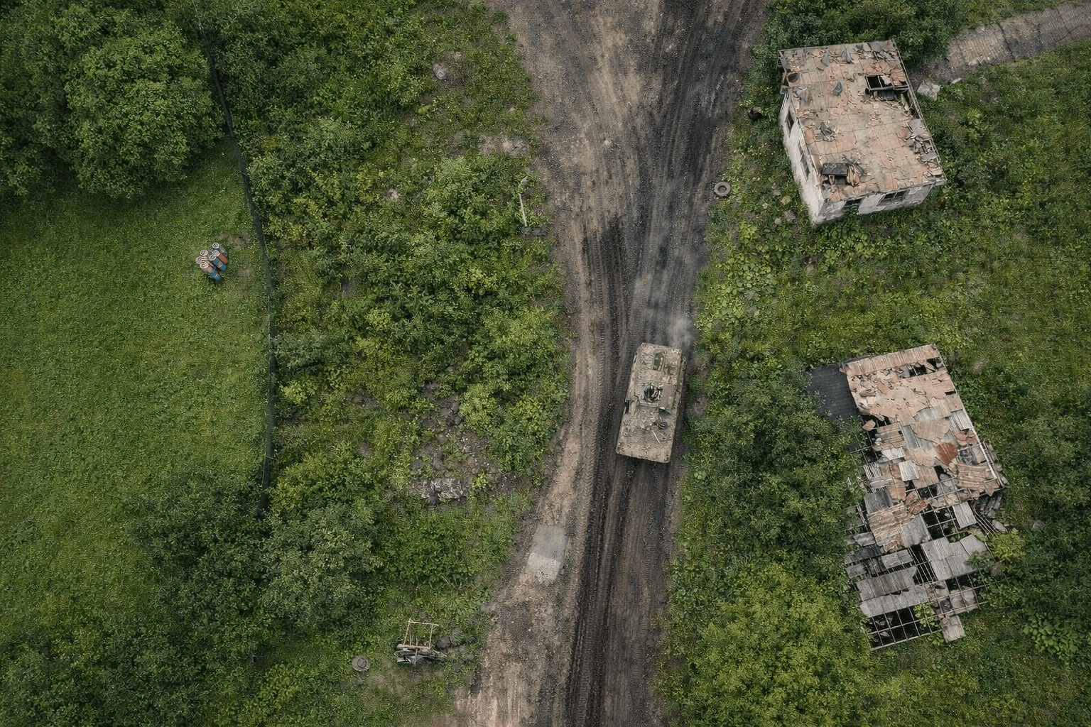
Drones and Farming: The Power Duo of Modern Agriculture 

For years, drones in agriculture were seen as optional. Useful, interesting, but not essential. That view has changed. Today, drones and farming are connected at the hip. 

DJI estimates roughly 400,000 agricultural drones are now in active use worldwide, across more than 100 countries and 300 crop types. In the United States, 75% of current agro users plan to expand their fleets, and a majority of non-users expect to adopt.

The surge in interest came from ongoing pressures. Labor shortages have turned routine fieldwork into a constraint. Input costs continue to rise. Weather variability shortens decision windows. Spotting problems late now has real financial consequences.

Drones can help (and already do) address these operational problems effectively, as the following cases illustrate. 

Seeing Crop Stress Before it Becomes Yield Loss

Crop health monitoring is where drones deliver the clearest return. Instead of doing intensive manual field walks or delayed satellite passes, farmers can run short scouting flights to scan the entire field in minutes. 

A helicopter view gives richer insights into crop wellbeing. RGB imagery can convey the following insights: 

  • Early signs of nutrient stress
  • Disease pressure
  • Soil compaction
  • Irrigation imbalance 

On top, multispectral sensors and indices like NDVI can provide even richer insights to quantify plant vigor and chlorophyll activity. So that scouting moves from observation to measurement.


With preventive data, you can cut down on chemical use and apply targeted treatments, so that crop quality and yield rise without as much cost pressure. Take it from Sunnyvale Orchards, a 500-acre specialty fruit operation. 

By combining drone-based monitoring with targeted application, the farm cut pesticide use by 35 percent, reduced water consumption by 40 percent, and improved crop quality by 15 percent. Given the value of the crop, the system paid for itself in under a year.

Optimizing Irrigation and Water Use

Water management is another great example of drones and farming synergy in action. 

Many irrigation problems are hard to diagnose from the ground. Overwatered zones, dry patches, runoff paths, and drainage failures often stay invisible until crops show stress.

Aerial data removes that blind spot. Drone flights reveal how water actually moves through a field. Dry areas sit next to saturated ones. Runoff paths become traceable. When paired with GIS tools and basic hydrological models, this shifts irrigation from reactive fixes to informed planning.

The value is most evident in water-constrained environments. In Sidi Bouzid, researchers used drones to support olive cultivation under severe water scarcity. Drone imagery combined with GIS-based watershed analysis exposed drainage patterns, erosion risks, and zones under water stress. The results showed significant variation between plots, enabling precision irrigation recommendations aligned with local hydrology.

Managing Livestock Without Walking Every Hectare

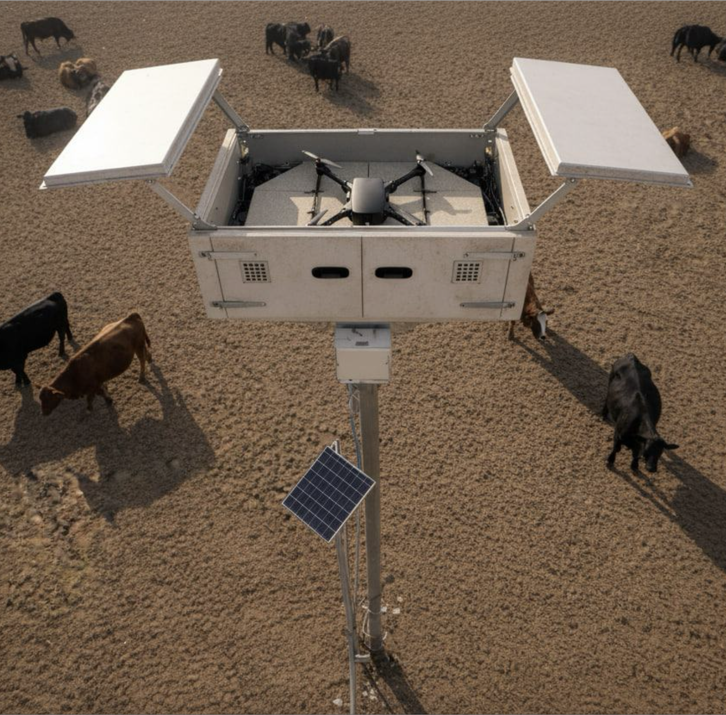
Livestock operations face a different constraint: scale. Land is vast, often remote, and slow to inspect. Locating animals, checking fences, and verifying water access can consume hours before any corrective work even starts.

Drones compress that effort. A single flight can survey large grazing areas, locate herds, and flag infrastructure issues without disturbing animals. The value isn’t novelty. It’s time to recuperate and have fewer blind spots.

For instance, Beefree Agro helped farmers deploy drone-based livestock monitoring across 

Israel, South America, and the United States. Its drone app runs scheduled missions to count livestock using thermal imaging. You can also use it to locate missing animals or assess pasture conditions — e.g.,  inspect fences and water infrastructure. 

In Australia, GrazeMate is pushing the model further. The company is developing autonomous drones for cattle herding and monitoring. Developed for DJI drones, the app relies on reinforcement learning to muster cattle. It automatically detects animals and helps move them from one grazing area to another or from pasture to a paddock. 

The second version of the app, currently in beta mode, will include more advanced analytics, enabling ranchers to estimate cattle weight and dry matter availability.

Planning Fields with Fewer Assumptions

Beyond day-to-day operations, drones increasingly support field mapping and planning. 

Fresh aerial maps provide more up-to-date views of field boundaries, slopes, and drainage as they exist today, not as they were logged years ago.

That accuracy matters. It informs planting and spraying routes, supports insurance claims after weather events, and underpins regulatory reporting. The value isn’t administrative polish. It’s fewer surprises during narrow decision windows, when errors are expensive and time is scarce.

A research project led by UF/IFAS Tropical Research and Education Center shows how this plays out in practice. Over three years, researchers studied nitrogen application in floral hemp using drone-based multispectral imagery to assess plant health ahead of harvest. The data clearly differentiated nitrogen levels, identifying the range that produced the healthiest plants and highest yields. By applying AI to canopy reflectance analysis, the system delivered real-time insights that closely matched harvested biomass. So that planning decisions moved from trial-and-error to evidence-backed thresholds.

Drones as Baseline Farm Infrastructure

Drones are no longer experimental tools in agriculture. They are becoming part of the operating baseline.

Their value doesn’t come from autonomy for its own sake. It comes from visibility, faster feedback loops, and decisions grounded in measured conditions rather than assumptions. The farms that benefit most treat UAVs like any other critical piece of equipment: integrated into workflows, flown routinely, and judged by outcomes.

If you’re interested in developing drone apps for farming, check out Osiris OS — an end-to-end, hardware agnostic software platform that combines a flight controller with an operating system running on the mission computer. With Osiris, you can seamlessly link your drone, flight controller, and sensors through plug-and-play integration to enable new drone capabilities. 

Top 8 Drone Interceptors On the Market Today

Hobby drones used to be a nuisance. Now we have a bigger issue.  

From Shahed-style loitering munitions to cheap quadcopters carrying ISR payloads, modern conflicts and critical-infrastructure sites are facing a volume problem. Missiles are effective but expensive. Drone jammers help, until they don’t. That’s why interceptor drones have quietly become one of the most important categories in counter-UAS.

Below are the top 8 most credible drone interceptor systems available today, with low cost per kill, high autonomy, and seamless deployability.  A few of them are also in a class of their own.

1. STING 

Source: UNITED24 Media 

If there’s a poster child for the “cheap beats exquisite” doctrine, STING is it.

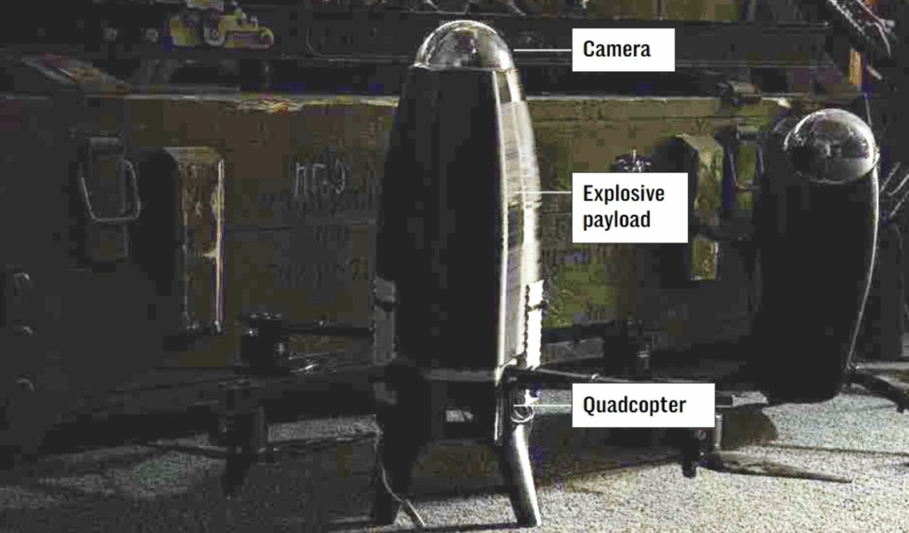
Built by the Ukrainian defense-tech group Wild Hornets, STING is a disposable quadcopter interceptor with a centrally mounted warhead and forward-facing camera. Operators fly it using VR goggles or a ground control station, giving precise situational awareness in the final seconds.

What makes STING remarkable is its economics. At $2,100 per unit, it costs a rounding error compared to missile interceptors. And yet it has allegedly downed 600+ more expensive enemy UAVs in five months, demonstrating a solid ROI.  Speed upgrades pushed it from ~160 km/h to 315 km/h, making it fast enough to catch most loitering threats.

Best for: Ultra-low-cost, high-tempo interception. 

Trade-off: It’s operator-dependent and designed to be expended. But when volume matters, that’s a major pro, not a nuisance.

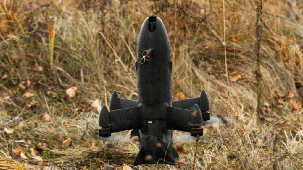
2. Octopus 

Source: Militarnyi

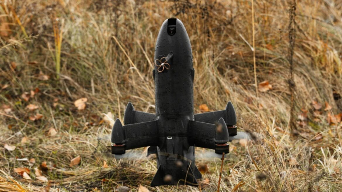
Octopus drone interceptor has an unmistakably distinctive look. 

This cylindrical interceptor, developed by Ukrainian engineers and refined with British industry support, uses image recognition for terminal guidance, allowing it to home autonomously in the final phase. That matters when jamming intensifies or the pilot’s reaction time becomes the bottleneck.

Octopus excels where many systems fail: night operations, low altitude, and contested RF environments. It avoids complex launch infrastructure and doesn’t rely on continuous ground guidance. Cost is also disciplined, coming in at under 10% of the target drone’s price.

The UK government has confirmed domestic production starting in January 2026, a strong signal that this system is moving from urgent wartime improvisation to sustained capability.

Best for: High-reliability interception under EW pressure. 

Trade-off: Less optimized for ultra-rapid, mass launches than disposable quadcopter interceptors.

3. Swift Beat 

Swift Beat doesn’t market aggressively, and that’s usually a tell of some serious advances. 

Backed by Eric Schmidt (former Google CEO), the company has been running in stealth mode. What is known, via Ukrainian government statements, is impressive: Swift Beat drone interceptors are said to account for roughly 90% of Shahed one-way attack drone interceptions in certain operational zones.

The platform reportedly blends AI-assisted navigation, targeting, and decision support across interceptors, ISR drones, and strike UAVs. Details are scarce. Results are not.

Best for: Quietly dominant battlefield performance

Trade-off: Availability and transparency. This is not an off-the-shelf system just yet. 

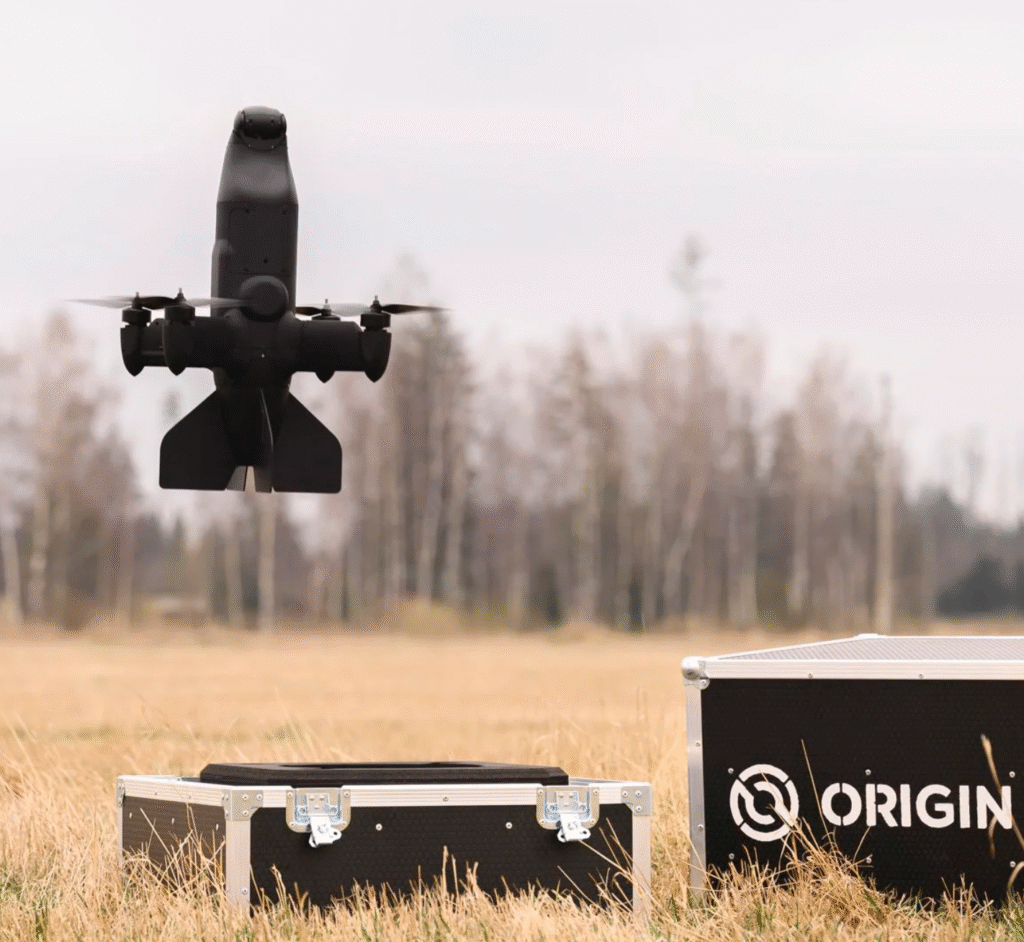
4. BLAZE

Source:  Origin Robotics

BLAZE is built for the scenario everyone worries about: multiple incoming drones, not all of them armed.

Developed by Latvian Origin Robotics, BLAZE combines radar-based detection with EO/IR sensors and AI-powered computer vision to determine which incoming drones are actually carrying munitions. That prioritization step is what separates it from many interceptors that treat every airborne object as equally dangerous.

From a deployment standpoint, BLAZE is refreshingly practical. It’s man-portable, requires no tools to assemble, and can be flight-ready in under ten minutes. Once configured, the first inceptor can fly out in under 5 minutes, and follow-up launches are under 60 seconds. 

Overall, BLAZE offers a good balance between autonomy and control. Target acquisition, classification, and intercept geometry are handled autonomously, but the operator remains in the loop for engagement confirmation. This reduces cognitive load without removing human oversight. 

Best for: Rapid-response defense against mixed or weaponized drone swarms 

Trade-off: BLAZE’ requires more setup discipline and trained operators. It’s best suited as a selective defense layer, not a brute-force saturation solution.

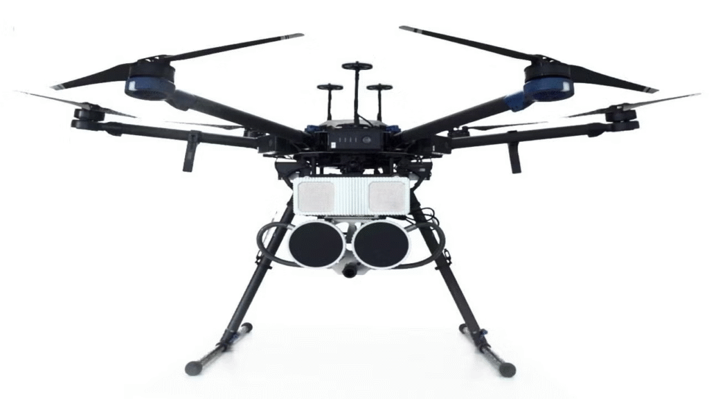
5. DroneHunter® F700

Source: Fortem Technologies

If you need to stop drones without blowing them up, DroneHunter® F700 remains the benchmark.

Built by Fortem Technologies, the F700 is fully autonomous and radar-guided, using Fortem’s TrueView® R20 radar to detect, track, and intercept targets day or night. What makes it stand out is its capture-first philosophy. Instead of destroying drones kinetically, the F700 uses net-based systems to neutralize them safely.

Smaller Group-1 drones are captured with tethered nets and physically carried away from sensitive areas. Larger Group-2 drones are handled using the DrogueChute™ system, which deploys a net attached to a parachute, forcing a slow, predictable descent. That predictability is critical when operating over crowds, critical infrastructure, or populated zones. The system is also fast to reset. Launch takes seconds, and the drone can be redeployed in under three minutes. 

Best for: Civilian airspace, urban environments, and zero-collateral interception

Trade-off: The F700 prioritizes safety over lethality. It’s not designed for high-speed, high-altitude battlefield threats. 

6.  P1-SUN

Source: Tech Ukraine 

Unveiled at the Dubai Airshow 2025, P1-SUN from SkyFall reflects how quickly Ukrainian interceptor design is evolving.

Built around a modular, partially 3D-printed airframe, the P1-SUN reaches 5 km altitude and recently increased its top speed by 50% over an already-formidable 300 km/h baseline, according to the company spokesperson. That speed expansion opens a new category of targets, including hostile helicopters, not just loitering munitions like the Geran-2.

Best for: High-speed pursuit and expanded target sets.

Trade-off: Less publicly available operational data than earlier Ukrainian systems, but it looks highly promising. 

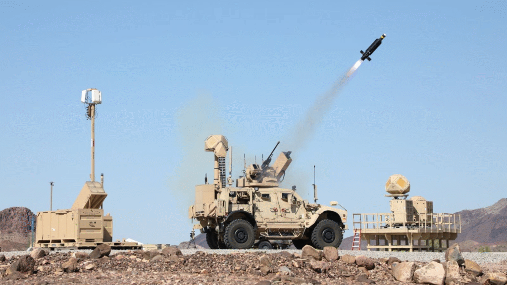
7. Coyote C-UAS

Source: Raytheon 

Coyote C-UAS sits at the heavy end of this list, both conceptually and operationally.

Developed by Raytheon, Coyote is a rail-launched, expendable interceptor that blends missile-like launch characteristics with drone-like flexibility. It uses a boost rocket for rapid acceleration, followed by a turbine engine, allowing it to reach longer ranges and higher altitudes than most drone interceptors.

Coyote comes in kinetic and non-kinetic variants and is designed to engage everything from single UAVs to coordinated swarms. It can be launched from ground vehicles, ships, or aircraft, and multiple Coyotes can be networked together for swarm defense scenarios.

The U.S. Army’s $5.04 billion contract award underscores its role as part of a broader integrated air and missile defense architecture, not as a standalone system.

Best for: Long-range, layered military air defense against drones and swarms.

Trade-off: Coyote is effective, but it’s not subtle. Launch infrastructure, logistics, and cost per engagement place it firmly in the military-only category. 

8. Interceptor-MR

Source: MARSS 

Interceptor-MR is designed for one job: winning the chase.

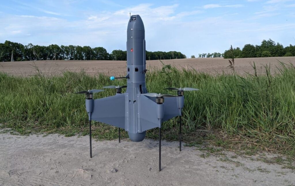
Built by MARSS, the incerseptor sports a hybrid airframe that combines the speed and efficiency of a fixed-wing aircraft with the agility of a quadcopter. It can reach speeds over 80 m/s while still performing aggressive, close-range maneuvering.

The interceptor is deployed from a vertical smart launcher integrated with MARSS’s NiDAR Core sensor network. Once a threat is detected and verified, Interceptor-MR launches vertically, acquires the target using onboard AI imaging, and pursues it with what MARSS describes as dogfight-level agility.

This makes it particularly effective against fast, evasive Class I and II drones that defeat simpler pursuit algorithms or slower quadcopter interceptors.

Best for: High-speed, highly maneuverable drone-on-drone engagements.

Trade-off: Interceptor-MR is a precision tool, not a mass solution. Its sophisticated propulsion and sensing stack mean higher unit costs and more deliberate deployment. It shines as a high-performance interception layer, not as a cheap answer to high-volume threats.

The Takeaway

Drone interceptors are still ‘coming of age’ as a technology. Many systems remain in limited supply and are mostly reserved for military purposes. 

That said, platforms like STING and Octopus show how cheaply and quickly air defenses can scale when volume matters. While interceptors like DroneHunter® F700 and BLAZE prioritize control, discrimination, and safety when operating near people or infrastructure. 

At the heavier end, Interceptor-MR and Coyote C-UAS belong in layered defense architectures where speed, altitude, and integration matter more than unit cost.

The right choice depends on where you expect drones to fail, and how many you expect to face.

Why Modern Drone Training Starts with Software, Not the Airframe

For years, drone training has followed a familiar pattern. Learn the airframe. Master the controls. Accumulate flight hours. Pass a certification. Fly and get paid for that.

That model made sense when UAVs were essentially remote-controlled aircraft with cameras attached. But it no longer holds true today. 

With more drones getting extended autonomy capabilities and more in-depth controls thanks to onboard apps, pilots need to go through a slightly different drone training routine.  

3 Ways Drone Training Differs Today 

As UAVs move from manually piloted platforms to software-defined systems, the skills operators need also evolve.  

Yes, the airframe still matters. But it’s no longer where expertise begins. Instead, pilots need to learn how to work alongside (semi)autonomous software and get into full-gear mode when the pressure rises. 

1. Drone Training Starts with Software, not Stick Skills

Earlier training programs prioritized manual flight proficiency. Today, most pilots spend more 

time on designing mission profiles on drone controller software, even before getting into the field. 

You need to be comfortable with configuring waypoints, validating flight parameters, and monitoring automation settings, rather than actively flying. Your role will be supervising and making snap decisions when conditions change. 

You’ve got to spend time learning the onboard UAV app features, mission planner, and payload logic to become an excellent pilot. 

2. Drone Software Now Defines What “Safe” Means 

Safety is no longer just about avoiding crashes. It’s about predictable behavior under uncertainty. When GNSS degrades or when vision fails in low contrast, the aircraft doesn’t suddenly become unsafe. The software decides how it compensates, degrades, or aborts.

Operators who don’t understand those logic paths are effectively blind during the most critical moments of a mission. So your drone training should always cover: 

  • Which assumptions the autonomy stack uses
  • What failure modes look like before they escalate
  • How fallback behaviors differ across configurations
  • When “hands off” is safer than manual intervention

This is especially true in industrial, emergency, and defense-adjacent operations, where operating environments are unpredictable by default.

3. Simulation Has Now Become a Primary Learning Tool 

Accumulated flight hours used to be the gold standard of competence for drone pilots. 

Today, high-fidelity simulation delivers more value, faster. 

Software-centric drone simulators expose novice operators to edge cases that are rare, risky, or impractical to recreate in live flight. GNSS degradation. Sensor disagreement. Delayed command links. These are the moments that define mission outcomes, and simulation lets operators experience them safely and repeatedly.

To get real value from simulation-based drone training, be sure to: 

  • Train failure modes, along with mission flows. Avoid practising only ideal missions. Focus deliberately on ‘hard cases’. Introduce navigation drift, delayed telemetry, partial sensor loss, or degraded visibility mid-mission. This way, you build out your situational judgment, not just muscle memory. 
  • Practice decision timing, not just decisions. Many incidents happen because the wrong action was taken too early or too late. Simulation allows you to see how long autonomy can self-correct before intervention is necessary. This builds restraint, which is often more valuable than fast reflexes.
  • Train handover moments explicitly. One of the highest-risk moments in autonomous operations is the transition between the drone autopilot system and manual control. Simulation should include deliberate handover drills so you understand what state the system is in when control changes and what inputs it expects next.

Ultimately, you should practice the same scenario with different parameters. Running one emergency scenario once teaches recognition. Running it ten times with small variations teaches understanding. Change wind profiles, sensor weights, or mission constraints and observe how system behavior shifts. This is how you learn to stay calm, collected, and efficient, no matter the operating environment. 

Final Thoughts 

Modern drones are shaped as much by software as by airframes. Mission planners, autonomy logic, sensor fusion, and fallback behaviors determine how UAVs operate once they leave the ground.

Effective drone training has to reflect that reality. It should teach you to plan missions with intent, interpret system behavior in real time, and make confident decisions when conditions change. Flight skills still matter, but they’re most effective when paired with a strong understanding of how the underlying systems work.

As autonomy becomes standard and operations grow more demanding, the strongest operators are those who train to work in step with their software. Master the system first, and the airframe becomes a tool you can rely on in any environment.

Drone Classes Explained: Which Capabilities Matter the Most?

When we talk about drone classes, we usually mean weight or airframe size. In reality, class is defined by capability: what the drone can do with its battery, hardware, and software. 

The truth is, every drone differs as much in its hardware characteristics and the type of UAV application layer it can support — and that’s what we’re looking into in this post. 

What are Drone Classes?

Most regulatory frameworks primarily group drones by mass or airframe size, e.g., Group 1 to 5 in the US. But such classifications give away little about the drone’s capabilities, i.e., what a certain model is expected to do. 


A more accurate way to identify drone classes would be by their mission profile, operating environment, and risk tolerance levels. For example, a consumer-grade drone and an industrial inspection drone may be of the same airframe size, but the latter has much stronger comms links and a greater degree of software-defined automation. 

Looking at the drone classes through this lens provides a more accurate basis for evaluating UAV capabilities and, critically, the UAV app architecture needed to support them.

In that sense, we identify the following three drone classes: 

  • Consumer drones, designed for short, low-risk flights under direct human supervision. 
  • Commercial UAVs, built to fly longer distances, carry heavier payloads, and perform automated workflows. 
  • Tactical and ISR-class UAVs can operate in high-risk or contested environments and rely on autonomy to complete missions when human control or GNSS is limited.

These differences shape the capabilities a UAV app must provide, from basic flight assistance to full mission autonomy.

Consumer Drones

Hobby drones for aerial photography or racing mostly use onboard OS as an assistive control layer. Flight software priorities center on stability, ease of operation, and rapid onboarding rather than autonomy or high fault tolerance. Mission logic is limited and typically constrained to simple waypoint execution or automated recovery behaviors.

Generally, such drones aren’t wired to operate under uncertainty. Loss of GNSS, sensor degradation, or connectivity link interruption is treated as an edge case rather than a core design condition. As a result, the application layer favors usability over resilience.

Key characteristics of this class:

  • GNSS-dependent navigation and stabilization
  • Basic waypoint missions and return-to-home logic
  • Mobile-first user interface with minimal configuration
  • Assumed operator presence and manual override
  • Little to no requirement for redundancy or autonomous decision-making

Commercial & Industrial Drones 

Commercial UAVs have higher operational expectations placed upon them. The UAV app must support repeatable workflows, predictable flight behavior, and consistent data capture across varied environments. Mission planning evolves into a structured process, often tied to timelines, asset geometry, or survey grids, with tighter coupling between flight paths and sensor payloads.

For this drone class, failure modes matter a lot. Health monitoring, failsafe logic, and positioning accuracy are no longer secondary concerns but must-have features for safe deployment. The drone controller shifts from enabling flight to enforcing operational discipline. So the defining question becomes whether the system can perform reliably under real-world constraints, not just whether it can complete a flight.

Key characteristics for this class:

  • Structured mission planning and repeatable execution
  • Integrated payload and sensor management
  • System health monitoring and defined failsafe states
  • Improved positioning accuracy and flight repeatability
  • Reduced reliance on constant manual intervention

Tactical, ISR, and Mission-Critical UAVs

Tactical-grade and ISR-class drones operate under the assumption that external dependencies will fail. GNSS may be unavailable or compromised. Communications may be degraded or severed at any moment. And operator input may be intermittent. So the onboard flight software must function as an autonomous mission controller, not just a flight assistant.

Navigation relies on multi-sensor fusion and continuous correction under interference or spoofing conditions. Autonomous take-off, precision hover, and return-to-launch have to be baseline capabilities. Deterministic behavior is mandatory. 

At this level, convenience-driven design gives way to resilience, predictability, and tightly controlled system responses. The UAV app becomes a mission-critical component whose failure directly translates to mission failure.

Key characteristics for this class:

  • GNSS-denied navigation and inertial or hybrid sensor fusion
  • Autonomous take-off, hover, and RTL execution
  • Real-time correction under EW or signal interference
  • Deterministic behavior and bounded system responses
  • Tight software–hardware integration
    Mission continuity with minimal operator dependency

Designing Scalable Apps for Multiple Drone Classes

As UAV platforms scale across drone classes, the application layer must scale with them. Hard-coded assumptions about GNSS availability, operator presence, or benign environments quickly become failure points when systems are pushed beyond their original mission scope. 

So a scalable UAV app architecture avoids class-specific rewrites by separating core navigation, control, and autonomy logic from platform-level constraints.

At its core, this means modular design. Sensor fusion, mission planning, and control loops should be adaptable to different hardware configurations and levels of autonomy without changing system behavior. As operational risk increases, the architecture must support deterministic execution, graceful degradation, and autonomy that doesn’t depend on constant external input.

You can build this type of drone controller with Osiris Drone OS — the first, fully vendor-agnostic unified drone app development platform with built-in support for autonomous flight, swarm coordination, and AI-powered decision-making.

Develop and deploy drone apps with computer vision capabilities and edge data sensor fusion. Seamlessly connect hardware, software, and mission logic across different drone classes without heavy reengineering. 

Contact us for a personalized platform demo. 

Why Modern Drone Apps Need a Hardware-Agnostic OS

Drone apps have come a long way. The baseline expectations among pro operators are real-time, no lag feeds, autonomous navigation, payload automation, and fleet-wide telemetry — all from software running on a tablet or ground station. 

Technically, that’s already possible with the current state of drone controllers. But practically, most teams run into a bunch of issues: fragmented hardware, mismatched autopilot firmware, and vendor-locked interfaces. The result is a paradox: software-driven missions are rising in complexity, but the foundation drone apps rely on remains brittle.

3 Technical Roadblocks That Hold Drone Apps Back

Drone apps may look sophisticated on the surface, but behind every clean interface sits a messy stack of incompatible hardware, inconsistent firmware, and timing issues that developers can’t fully control. 

The next hidden system-level constraints are the reason even the best apps fail under pressure. 

Fragmented Hardware Ecosystem

Airframes don’t have a shared “lingo”. A quadcopter relies on a different combo of ESCs, IMUs, radios, battery systems, and payload interfaces than a VTOL. And even within the same class (e.g., FPV quadcopter vs inspection quadcopter), wiring schemes, timing behavior, and sensor stacks differ a lot across manufacturers. 

So drone apps built for one platform rarely behave the same on another. Navigation logic might drift. Sensor timing may desync. Payload triggers misfire. And every time a developer tries to support a new airframe, they end up rebuilding integrations from scratch.

This fragmentation makes it almost impossible to scale mission software across fleets. 

Vendor-Locked Flight Firmware

Most drone apps don’t directly control flight. They sit on top of firmware like ArduPilot, PX4, or proprietary drone autopilots. Each of these handles navigation, EKF algorithms, safety logic, and sensor fusion differently. That divergence cascades upward: 

  • APIs behave inconsistently
  • Low-level timing varies
  • Telemetry frequency shifts with load.

Effectively, the same command can produce different aircraft responses across platforms. So developers have to come up with workarounds instead of building features. And when the firmware updates, those workarounds often crash. 

This leaves mission apps fragile in the environments that need them most — contested airspace, GNSS denial, low visibility, or complex sensor workflows.

Painful Payload Integration

Professional missions no longer rely on a simple gimbal camera. Operators now expect drones to carry:

  • EO/IR modules
  • LiDAR sensors
  • Multispectral arrays
  • RF relays
  • SIGINT receivers
  • Industrial inspection payloads

Each payload often uses a different protocol: UART, CAN, Ethernet, MAVLink variants, manufacturer SDKs, or fully proprietary command sets.

Most drone apps aren’t built to handle this chaos. They depend on the flight controller to coordinate everything — except the flight controller was never designed to manage heterogeneous, timing-sensitive payloads.


As a result, operators struggle with delayed trigger commands, inconsistent data alignment, or even mission aborts under heavy load. 

How Hardware-Agnostic OS Solves These Pain Points

A hardware-agnostic drone OS like Osiris Drone OS absorbs the complexities of adapting different drone apps to different airframes through a unified abstraction layer, consistent APIs, standardized sensor fusion, and edge AI orchestration. 

Unified Abstraction Layer Across All Airframes

A hardware-agnostic OS standardizes the layer between mission apps and the aircraft’s physical components. Motors, IMUs, barometers, radios, power systems, and peripheral sensors all map into a single, consistent interface.

Developers no longer need to write separate logic for:

  • quadcopters vs VTOLs
  • electric vs hybrid propulsion
  • tethered systems vs free-flight
  • single-gimbal setups vs multi-sensor arrays

The OS normalizes how each subsystem communicates, so apps behave the same whether they’re running on a compact quad or a heavy-lift inspection platform.

Consistent APIs for Mission Apps

Instead of relying on unpredictable firmware behaviors, a hardware-agnostic OS provides stable APIs designed for mission-critical workloads. Timing is consistent. Sensor fusion outputs are consistent. Flight-state data is consistent.

Apps can issue mission commands without worrying about:

  • how a specific autopilot parses MAVLink
  • whether a firmware update changes command timing
  • whether sensor refresh rates shift under load
  • whether the airframe interprets throttle or yaw differently

The OS handles the translation. Developers write cleaner, more reliable logic — and operators experience fewer mid-mission surprises.

Standardized Sensor Fusion and Timing

Modern flights rely on coordinated data across multiple sensors: IMUs, barometers, visual-inertial odometry, radar, optical flow, LiDAR, and GNSS (when available). On legacy systems, each sensor behaves differently depending on the platform.

A hardware-agnostic OS solves this by centralizing sensor fusion. It can handle:

  • timestamp alignment
  • sensor health monitoring
  • fallback logic under GNSS loss
  • redundancy across IMUs
  • timing corrections for jitter
  • integration with AI-based navigation layers

Effectively, the OS churns out normalized, reliable outputs — even in high-entropy environments — to the apps running on top. 

Edge-Level AI Orchestration 

A hardware-agnostic OS also unlocks true autonomy. AI models — for navigation, collision avoidance, object detection, or mission planning — can run directly on the drone without needing custom integrations for each model.

The OS manages:

  • compute scheduling
  • thermal throttling
  • sensor input fusion
  • low-level actuation
  • fallback behaviors

This enables advanced capabilities like GNSS-denied hovering, synthetic GPS, automated RTL, and resilient ISR — regardless of the airframe.

Discover all of these capabilities (and more!) in Osiris Drone OS that supports autonomy-first design, modular app architecture, and low-SWaP deployments on all major airframes. 

Osiris AI × DefDrones: New Strategic Partnership

We’re excited to share that Osiris AI has entered into a new partnership with DefDrones. Together, we’ll be working on integrated hardware-software solutions for modern unmanned systems.

In simple terms, we’re combining our operating system OsirisOS with DefDrones high-performance electronic components. This will help drone and robotics manufacturers get reliable, scalable products up and running much faster — with all parts already optimized to work together.

For us at Osiris AI, this partnership is a natural next step. We’re now expanding our engineering team and scaling OsirisOS to support more manufacturers and more types of unmanned platforms. Working with DefDrones will help us move even quicker and offer ready-to-use, integrated solutions.

“Our goal is to build the next-generation operating system for drones and robots. Teaming up with DefDrones helps us speed up OsirisOS development and deliver complete, integrated solutions to our partners,” said Roman Onyshchenko, CEO of OSIRIS AI Ukraine.

“This partnership will help us further improve our electronics and integrate them more deeply with OsirisOS-based software,” added Petro Dobryanskyi, Director and Co-Founder of DefDrones.

Osiris AI — a Ukrainian deep-tech company building OsirisOS, an operating system and ecosystem for unmanned and robotic platforms.
DefDrones — an engineering company that develops and supplies high-performance microelectronic components for unmanned systems.

5 Must-Have Features for a Professional-Grade UAV App

For UAV developers, the application layer has become the real center of gravity in modern drone systems. Airframes, motors, and ESCs may define physical performance. But it’s the software stack — navigation algorithms, autonomy modules, mission logic, and payload orchestration — that determines whether an aircraft can fly complex missions. 

In the field, conditions are never ideal. Signals degrade. Multipath distortions accumulate. Payloads introduce vibrations and timing offsets. All of these place significantly more responsibility on the UAV app itself.

A professional-grade UAV app must therefore extend far beyond waypoint planning and include the next five advanced features: 

1. Integrated Mission Planner with Autonomous Execution

Professional operations require a drone mission planner that acts as an autonomous state machine capable of handling dynamic context.

Key requirements include:

  • Automated route generation based on mission parameters, geofenced constraints, or operator inputs.
  • Real-time path adaptation, where the planner recalculates trajectories based on sensor readings, environmental changes, or operator overrides.
  • Obstacle-aware behavior, integrating perception inputs or external feeds.

To enable the above, advanced drone autopilot systems increasingly rely on edge ML and DL algorithms deployment. State-of-the-art models can effectively handle adaptive trajectory planning, obstacle prediction, sensor fusion, and anomaly detection directly on the mission computer with minimal latency. 

By deploying AI on the edge, you ensure strong autonomy even when bandwidth is limited, comms links drop, or GNSS becomes unreliable.

2. GNSS-Denied Navigation Support

Build your UAV app with the assumption that GPS signals can be fickle. Signal jamming is prevalent in conflict zones, near critical infrastructure, and across some industrial sites. Visual cues may be unavailable in maritime, fog, smoke, or low-light missions.

A professional UAV app must therefore include:

  • Hybrid INS with AI-based drift correction, capable of maintaining position hold without satellite input.
  • Precision hovering using inertial and model-based estimators.
  • Autonomous takeoff, landing, and RTL executed purely from inertial and system-state awareness.

Developer takeaway: your UAV app must assume GNSS is optional. The navigation module cannot collapse into undefined behavior when GNSS is lost. It must gracefully fall back to internal state estimators, and it must do so deterministically.

3.  Hardware-Agnostic Flight Control Integration

Most developers must support fleets running mixed autopilots, diverse airframes, and non-standard payloads. This makes hardware abstraction essential for a UAV app. Consider functionality for: 

  • Synthetic GPS output compatible with popular open-source and custom FC stacks, enabling seamless drop-in replacement of degraded GNSS.
  • Low-SWAP navigation hardware that integrates without requiring structural modifications or custom power systems.
  • Heterogeneous payloads — EO/IR, LiDAR, multispectral, RF modules — with clean synchronization and control APIs.

This level of abstraction, available in Osiris Drone OS, decouples the application layer from vendor-specific hardware constraints and reduces integration friction. Effectively, you can deploy your UAV app across quadcopters, VTOLs, tethered platforms, or hybrid propulsion systems without rewriting navigation or mission logic.

4. Payload and Sensor Synchronization

Payload control must be tightly integrated with the navigation and mission layers if you want to support advanced operating scenarios. High-quality ISR footage, mapping datasets, LiDAR point clouds, and multispectral imagery all depend on precise temporal alignment between aircraft attitude, velocity, and payload actions.

A technically robust UAV app must provide:

  • Deterministic triggering pipelines to support for EO/IR shutters, LiDAR firing, multispectral capture and similar manipulations.
  • Time-synchronization mechanisms such as PPS, PTP, or hardware sync pins to align sensor events with navigation states.
  • APIs for custom payload modules, enabling developers to integrate nonstandard hardware without rewriting core flight logic.

Proper synchronization prevents spatial distortions in mapping, drift in ISR sequences, and inconsistencies in any task requiring spatial correlation between flight trajectory and sensor output. For developers, this is the difference between raw telemetry and mission-ready data products.

6. Long-Range, High-Accuracy Control and Telemetry

At the developer level, long-range operation is a telemetry and control problem before it is an airframe problem. The UAV app must ensure stable state estimation, predictable command execution, and resilient data links across extended VLOS or BVLOS missions.

A mature control/telemetry architecture should include:

  • High-integrity command channels with prioritized message queues for critical flight commands versus low-priority payload data.
  • Reliable telemetry streams to obtain position, navigation states, system health, CPU load, power consumption, and sensor quality metrics.
  • Failsafe logic integrated directly into the app: link-loss behaviors, automated return profiles, and state-machine transitions that don’t require operator intervention.

Real-world testing — such as long-duration, non-GNSS flights maintaining stable RSSI and endpoint accuracy — demonstrates the importance of a well-architected control/telemetry loop. Without this, even the best autonomy modules degrade quickly due to distance or interference.

Final Thoughts 

The bottom line? Your autonomy stack is only as powerful as the OS it runs on. A mission planner, navigation module, or payload controller can’t reach full capability if it’s built on a fragmented software layer that struggles with synchronization, hardware abstraction, or real-time decision-making.

This is where Osiris Drone OS becomes a force multiplier. It’s a unified onboard software platform that merges a robust flight controller with an operating system running on the mission computer, giving developers a hardware-agnostic, modular environment for building high-level autonomy. Osiris enables targeted autonomous actions, ensures safe mission execution, and provides clean interfaces for both hardware and software components. And because it supports installable applications, you can load mission-specific modules, build 

custom behaviors, or extend the system with your own AI-driven logic.

Learn more about Osiris Drone OS

Drone Controller Technology: 3 Features That Matter for Mission Success

In high-stakes UAV operations, the drone controller is a mission-critical system responsible for aircraft performance and reliability.

When the GPS signal goes down, visibility worsens, or interference gets in your way, the controller becomes the pilot’s most important source of stability, navigation accuracy, and sensor coordination. 

The best drone controllers deliver a specific set of capabilities that shape flight precision, data integrity, and overall mission success. Here is what we advise you to look into.

3 Core Capabilities For a Drone Controller

For professional and tactical operators, a capable controller becomes the difference between a successful mission and a grounded asset, especially when visibility drops, GPS degrades, or electronic warfare interferes.

A good drone controller is your tactical aid for aircraft stabilization and near-instant corrective responses. For that, it has to support the next three features. 

1. Precision Navigation & Position Holding

Sub‑meter accuracy is non-negotiable if you’re running ISR missions, industrial inspections, or photogrammetry shoots. Look for controllers with superior hardware:

  • High-quality MEMS IMUs 
  • Strong GNSS receivers 
  • Barometric altimetry

Several commercial and defense‑grade controllers fit the above characteristics. CubePilot’s Cube Orange+ paired with Here3+ RTK GPS/GNSS offers centimeter‑class positioning on open‑architecture systems like Osiris OS

At the tactical end, Collins Aerospace’s Athena hub integrates INS, GPS, and full ADAHRS in a sealed enclosure that maintains precise attitude and heading over wide temperature and dynamic ranges. Compared to hobby‑grade controllers, which quickly lose stability in low visibility or featureless terrain, these systems keep the UAV steady in darkness, fog, urban canyons, or environments with no visual cues at all.

Bonus points if the drone controller is compatible with custom drone apps, e.g., for vision-aided or INS-based navigation. The most advanced drone controller systems can layer in alternative navigation methods such as radar velocity sensors, magnetic anomaly, or celestial cues. 

For instance, Honeywell’s Resilient UAV Navigation Suite integrates a compact INS with radar velocity measurements and anti‑jamming GNSS to keep position error under a few percent of the distance travelled. Even when satellites are denied or spoofed. 

2. Autonomous Flight Capabilities

Autonomy features ease the cognitive load of repetitive tasks —  takeoff, landing, return‑to‑home, and precision hover. It also co-pilots you on longer cruising missions with features like real‑time state estimation, trajectory planning, and obstacle‑aware path control. 

Advanced autonomy also incorporates contingency logic. When GPS crumbles or RF links weaken, the drone controller can help you stabilize the aircraft, maintain orientation, and follow pre‑defined recovery logic until the signal returns.

Systems such as Skydio Autonomy Engine pair dense visual sensing with onboard compute to navigate cluttered spaces with minimal pilot input, while Auterion’s Skynode X flight controller uses PX4‑based mission automation to manage route execution, failsafe behaviors, and precision landings. 

These features help you concentrate on mission‑level decisions, rather than constant corrective movements to compensate for drift or improve vehicle stability.  In contested environments, autonomy also comes as a great safeguard against losing your assets. 

3. Seamless Payload and Camera Controls

Professional drone controllers don’t just fly the aircraft. They orchestrate the entire sensing stack. That means managing EO/IR cameras, LiDAR scanners, multispectral payloads, sprayers, and any custom equipment riding under the airframe. 

At the hardware level, this requires:

  • Stabilized gimbal outputs
  • PWM and UART channels
  • Dedicated trigger lines
  • Time-sync interfaces like PPS

At the software level, controllers must expose protocols that allow mission systems to schedule captures, steer gimbals, and adjust sensor settings in sync with aircraft position and attitude.

Open-architecture stacks such as CubePilot running ArduPilot or Osiris OS are a great choice for the task. MAVLink camera and gimbal messages let teams script capture events by distance, altitude, or waypoint. This is how mapping teams achieve consistent ground-sample distance: the controller fires the camera at exact intervals and logs precise pose data for every frame. 

Enterprise platforms go further by pairing drone piloting systems with onboard Linux compute, giving engineers clean SDKs and standard interfaces for integrating third-party sensors and coordinating data collection with flight paths.

On tactical UAVs, the workload expands from imaging to SIGINT receivers, EW payloads, and communication relays. Here, deterministic timing is non-negotiable. You’ll want a controller with  PTP, GPS-disciplined clocks, or shared PPS lines to ensure seamless data flow between the payload and your navigation system. 

Final Thoughts 

A high-performance drone controller sets the tone for every mission. It shapes how precisely the aircraft flies, how reliably it collects data, and how confidently a pilot can navigate in difficult airspace. 

To get the best gear: 

  • Choose open architectures when possible. Flexible software stacks and standard protocols create room for rapid upgrades. 
  • Prioritize timing accuracy. Look for controllers that provide clean time-sync interfaces across every payload channel.
  • Match the controller to your payload class. Heavier sensors, higher data rates, and advanced gimbals call for stronger onboard compute.
  • Plan for redundancy. Multiple navigation inputs, resilient GNSS, and backup communication paths protect the aircraft when conditions shift.

The Future of Drone Insurance: Protection Against Aerial Risks

Airports grounded. Energy generation facilities disrupted. Data centers surveilled from above. The threat no longer comes through firewalls — it comes from the sky.

As drones evolve from hobby devices into advanced reconnaissance and attack tools, they’re creating an entirely new risk category for insurers and enterprises alike. While cyber risk has well-established frameworks, aerial threats are still largely undefined, yet growing impossible to ignore.

The global consensus is that rogue drones will remain a persistent threat because they’re a low-cost and high-impact. But can leaders count on “anti-drone insurance” as a possible remedy? Here’s our take.  

Drone Threats are a Global Nuisance 

Unauthorized UAV activity has spilled outside of military zones. Airports, oil refineries, power stations, and corporate campuses have been attacked all over the world. The successful 2019 drone assault on Saudi Aramco’s oil facilities was a harbinger. A July 2020 drone crash near a Pennsylvania energy substation and subsequent incidents around New Jersey, New York, Maryland, Minnesota, and Pennsylvania rattled the US operators.  

Across the pond, European leaders have been in high alert mode since February 2022 as the rate of unidentified drone flyovers increased with the start of the Russian war against Ukraine. As recently as September 2025, Denmark had to raise the security level of its energy infrastructure to the second-highest tier, following numerous drone sightings over its energy and military infrastructure. Munich Airport had to shut down twice, following suspicious drone traffic. 

Consumer drones are as cheap as ever, while jammers and spoofing kits are readily available online. Techniques once confined to conflict zones — like using low-cost drones for surveillance, sabotage, or coordinated swarm attacks — are now accessible to anyone searching well enough. 

In contrast, even “minor” incursions can cost millions for the targets. But most businesses don’t yet have effective means to soften the impacts. 

The Insurance Market is Catching Up to Drone Threats 

Traditional property or liability policies rarely account for drone-borne threats. Traditionally, losses fall into terrorism, war, or sabotage exclusions, leaving businesses uncovered. In response, carriers are trying to ‘plug this gap’ with new offerings. 

Terrorism and Political Violence Coverage

In the UK, where rogue drones became a common sight near airports, Air Force bases, industrial and correctional facilities, several drone insurance schemes are emerging. 

Pool Re’s terrorism reinsurance product now includes unmanned aircraft within “all-risks” policies for commercial properties in Great Britain. Other major carriers like AIG, Allianz, and Lloyd’s syndicates have also introduced political-violence coverage explicitly listing drone attacks as insured perils. These policies promise to cover property damage and business interruption, even when the physical impact is limited.

War-Risk and Infrastructure Protection Programs

In conflict zones, new “war-risk policies” are emerging with coverage for drone and missile-induced damage. In Ukraine, the government teamed with a local insurer, ARX,  to offer up to $50 million in coverage for assets like commercial real estate, energy facilities, and factories. 

On the flip side, however, anti-drone insurance policies in high-conflict zones come with raised premiums. Other carriers may be choosing to withdraw their policies altogether. In other words, insurers remain cautious about extending new offers in markets where drone attack risks are high. 

Operator and Liability Extensions

At the same time, standard drone pilot insurance policies, required of commercial operators in many markets, now include extended liability clauses. Insurance like AIG now offers optional hijacking and terrorism coverage, protecting pilots from liabilities if their UAVs are spoofed, jammed, or repurposed in an attack.

Building Real Protection: Beyond Drone Insurance Policy Coverage

Insurance alone won’t stop an attack. Effective drone prevention starts with testing and technology. To safeguard your assets, consider this two-step approach: 

1. Red-team / blue-team simulations

Running controlled UAV attack simulations exposes weaknesses in airspace monitoring and response protocols. Red teams attempt incursions; blue teams counter them using radar, RF, or AI-powered detection. The result: measurable data for insurance underwriting and internal risk assessments.

At Osiris AI, we run advanced drone defence simulation exercises on 3D digital twins, based on real-world geospatial and OSINT data. A red team of up to five simulates the attack path, and a blue team of the same size and skill works to repel the intrusion. 

During an after-action review, we analyze the vulnerabilities and defense gaps. Then, suggest cost-effective asset protection strategies. 

2. Counter-Drone Systems Deployment

Once the vulnerabilities are known, we recommend investing in a tailored anti-drone system. Depending on your asset type, it can feature a mix of RF sensors, jammers, optical trackers, or interception drones. 

These safeguards offer baseline protection — and they can also entice insurers to consider extra policy coverage or lower future premiums. 

The Bottom Line

Aerial risk is the next frontier of operational security. As the sky becomes as contested as cyberspace, businesses that test, fortify, and insure today will be the ones still operating tomorrow.

The future of drone insurance won’t be reactive—it will be predictive, informed by live threat intelligence, counter-UAV technology, and data-driven underwriting.
Protection, after all, starts before impact.

Tactical Drone Training: Which Skills Should You Hone?

Spotting the difference between a hobbyist and a true tactical drone pilot isn’t hard once you know what to look for. The pros have one thing in common: hours of structured drone training behind their belts. 

If you, too, want to level up your flying game, start by mastering these core skills. 

1. Advanced Flight Control & Manoeuvring

Routine waypoint flying is a commodity. You need to learn how to do tight maneuvers under stress: obstacle weaving, dynamic altitude changes, aggressive turns, rapid target shifts, and reaction to unplanned contingencies (gusts, turbulence, signal latency).

Training tips: 

  • Download an FPV drone simulator with real-world physics, turbulence, latency, and sensor feedback. Our top recs are VelociDrone and LiftOff. We love them for their realistic flight dynamics, customizable environments, and excellent track-building functionality. 
  • Create challenge courses. Perfect your techniques in urban canyons, dense foliage, and around obstacle towers. Try to reduce margins with each session. For an extra challenge, practice occasional emergency recovery drills (e.g., with sensor or rotor failure).  

2. BVLOS and Long‑Range Navigation

Many tactical missions require extended reach — pipeline inspections, border patrolling, convoy overwatch. Operating beyond visibility demands higher confidence in autopilot, control link robustness, and situational awareness.

Training tips: 

  • Simulate BVLOS challenges — temporary coms link dropouts, latency spikes, and waypoint handoffs — in your simulator to stay sharp no matter what. 
  • Incorporate lost-link recovery and manual takeover drills. Fly test scenarios where your drone intentionally loses signal or GPS lock, then regains control manually or triggers autonomous return-to-home modes to ensure you can handle real communication failures with confidence.

3. Payload & Sensor Mastery

A strong hold of payload controls separates the noobs from the pros. Modern UAVs come with a great variety of payloads — EO/IR cameras, LiDAR, EW payloads, or multi-spectral sensors — and designated drone apps to control ‘em. To make the max out of these extras, you’ll need some practice with payload controls and sensor issue troubleshooting. 

Training tips: 

  • Schedule dual-imaging drills. For example, with one camera in RGB, another in IR. Task yourself to fuse both streams, classify objects, and mark targets.
  • Train payload & gimbal control while doing aggressive maneuvers — high-speed passes, tight S-turns, rapid altitude climbs, or quick yaw pivots — to build up your confidence. 

4. Electronic Warfare (EW) and Signal Resilience

Weak GPS signal and high interference are often part of flying in industrial environments. And if you ever “graduate” to contested spaces, GPS jamming and signals spoofing are almost always a given. As an ace drone pilot, you need to know how to manage and mitigate such risks.

Training tips: 

  • Practice GPS-denied navigation, combining inertial, vision, and manual input. Start by flying short routes with GPS disabled in controlled test zones, rely on onboard IMU and visual odometry to maintain orientation, and gradually progress to longer or more complex routes using visual landmarks and telemetry cues to correct drift.
  • Drill signal loss recovery, re-acquisition, and safe landing routines to develop muscle memory. 

5. Situational Awareness & Cognitive Load Management

Most UAV flights involve multitasking. You have to stay atop of telemetry, visually assess your surroundings, and coordinate with other operators or on-the-ground personnel. That’s some taxing cognitive load. So your drone training routines should also prepare you for that. 

Training tips: 

  • Add stress-injection elements to your drills. For example, a simulated airspace conflict or an emergency prompt to train on-the-fly action prioritization.
  • Practice parallel tasks like tracking a target while answering comms to improve your attention and decision-making under pressure. 

6. Counter‑Drone Thinking

Knowing how an adversary can jam or intercept your drone is essential for any future ISTAR pilot. Training yourself to think (and act) like a red team builds sharper instincts and faster reactions. You’ll need both in the field. 

Training tips: 

  • Simulate mock counter-UAV events, e.g., interference zones, spoofed waypoints, drone intercepts, during your drills. 

Final Thoughts 

Pro-level tactical pilots focus on repeatable skill over showmanship. To progress, your drone training sessions should target dynamic flight control, BVLOS navigation, situational awareness, multitasking, and payload management. Select rotating days when you practice each of these competencies in a flight simulator to develop muscle memory.