What Are Unmanned Surface Vessels Used For? 6 Emerging Applications
As maritime missions get more complex and expensive, crewed vessels are becoming too slow or too risky to employ for every job. In their place come unmanned surface vessels.
An unmanned surface vessel (USV) is a crewless craft that operates on the water’s surface. Some are remotely controlled. Others can follow planned routes, avoid obstacles, process sensor data onboard, and feed information back to remote teams.
These are more than just “boats without crews.” What USVs bring is a more autonomous and data-led approach to maritime operations.
6 Real-World Applications of Unmanned Surface Vessels
A number of USV applications have moved beyond the concept deck and straight to the sea. The new generation of vessels is now actively helping maritime teams cover larger areas in less time and conduct activity in contested zones.
Maritime Surveillance
Maritime surveillance is one of the clearest use cases for unmanned surface vessels. The global seas are vast, and suspicious behaviors often remain undetected.
The Danish Navy has just completed a three-month test of Saildrone Voyager USVs in the Baltic Sea. Voyager is a 10-meter robotic vehicle, designed for coastal surveillance and nearshore mapping missions. With a mapping speed of 5 knots and an impressive 100-day endurance between stops, it can autonomously cover vast areas, supplying the NATO teams with round-the-clock maritime ISR.
Saildrone Voyagers have also been used by US Customs and Border Protection and the US Coast Guard off San Diego, where it has been tasked with detecting and classifying small vessel traffic. Equipped with a pan-tilt-zoom electro-optical and infrared camera, plus an onboard GPU, the onboard ML algorithms identified vessels, which deviated from expected traffic patterns with 94% accuracy. Overall, a fleet of 5 Voyagers made over 30,000 detections over the course of the missing, saving significant time and resources to human patrol teams.
Offshore Infrastructure Inspection
Offshore infrastructure is expensive to inspect and even more expensive to neglect. Pipelines, platforms, cables, and offshore energy assets need regular inspection, but conventional methods heavily depend on weather windows and personnel availability.
USVs are less immune to poor weather conditions and prove to be way more cost-effective than crewed vessels.
Eni Energy Netherlands recently employed Fugro’s Blue Essence USV to inspect offshore assets without putting survey personnel at sea. Fugro reported 132 hours of sub-bottom profiler acquisition, 238 hours of multibeam echosounder acquisition, and more than 1,000 linear kilometres of bathymetry data collected. The project also delivered seven days of continuous 24-hour operations, monitored 282 kilometres of pipelines, completed 26 platform inspections, and saved 290 tons of emissions compared with conventional methods.
That is where USVs become more than a robotics story. They become a safety, cost, and emissions story. Offshore operators can shift more work to remote centres, reduce fuel burn, and send near real-time inspection data to engineers onshore. Less theatre. More operational leverage.
Hydrographic Surveys
Hydrographic survey is one of the more mature civilian applications for USVs. Ports, coastal authorities, energy companies, researchers, and navies all need accurate seabed data. Traditionally, that work has relied on crewed survey launches moving slowly across defined routes. Useful work, but hardly frictionless.
Exail’s DriX vessel is changing the equation. First launched in 2017, the vessel has already
accumulated more than 15,000 operational hours globally, supporting energy and geoscience data acquisition. Compared to manned ships, DriX has longer operating windows and higher survey speeds
The advantage comes from parallelization. A crewed vessel can act as a mothership while
USVs extend the survey footprint around it.
A USV can cover areas that would otherwise require more boats, more crews, or longer campaigns. It can also reduce risk in shallow or congested waters where crewed vessel manoeuvring gets awkward fast.
NOAA’s Ocean Exploration Cooperative Institute acquired a DriX USV and a universal deployment system after sea trials with NOAA’s Thomas Jefferson hydrographic survey vessel, with the aim of expanding ocean mapping efficiency from a single research vessel.
Environmental Monitoring
Similar to surveying, aquatic environments’ monitoring is often periodic, expensive, and weather-dependent. An unmanned surface vessel can go into the field when crewed vessels would be impractical or unsafe.
Since 2021, NOAA has been using Saildrone USVs for hurricane research. Across a range of missions, 21 USVs intercepted 21 named hurricanes and tropical storms on 46 occasions, spending more than 2,600 days supporting hurricane research.
Hurricanes traditionally intensify over water, but the exchange between ocean and atmosphere remains difficult to observe directly. Saildrone USVs have ruggedised wings, designed to withstand the harshest tropical cyclone conditions. So research teams can collect continuous metocean observations.
Environmental monitoring also extends well beyond hurricanes. USVs can track water quality, salinity, current patterns, algal blooms, coastal erosion, fishery conditions, and pollution events. Their value is persistence. A one-off sample captures a moment. A USV mission shows how conditions change across space and time.
Mine Countermeasures
Minefields are designed to punish human presence. Modern naval mines can sit on the seabed and respond to acoustic, magnetic, or pressure signatures. Searching for them with crewed assets is risky and operationally expensive.
With USVs, naval teams can deploy sensors, sonar arrays, AUVs, and disposal systems in danger zones without exposing any personnel to risk. The industry is also moving toward system-of-systems designs, where the surface vessel acts as a carrier, coordinator, and communications node for underwater assets.
Maritime Robotics recently presented the Eelume WP960, a USV purpose-built for mine countermeasures and complex underwater operations. The platform can operate autonomously or in a group to sweep large areas with sonar or multibeam echosounders. Each WP960 can also carry Eelume S All-Terrain AUVs — highly maneuverable underwater vehicles or ROVs for higher precision work.
The concept matters because mine clearance rarely depends on one platform doing everything. A USV can carry and coordinate the mission. AUVs can search wider areas. ROVs can inspect objects more closely. AI-based decision support can help classify threats from sensor data faster. The useful system is the combined one.
Naval Strikes
The most visible and controversial use of USVs is for naval strike. Ukraine’s use of maritime drones in the Black Sea has shown how relatively small unmanned vessels can take down larger tankers and military vessels.
Strike USVs are designed to run long ranges, attack from unexpected directions, and carry a wide range of payloads. A relatively low-cost vessel can easily damage port infrastructure or logistic routes, forcing adversaries to spend more on detection and defence. In that sense, the USV acts as a cost-imposition tool as much as a weapon.
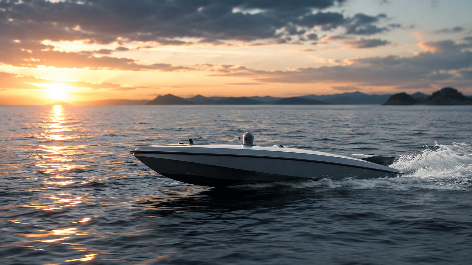
Across the Atlantic, BlackSea Technologies is working on naval strike technology. Its latest platform, Comet, is a 13.1-metre USV designed for high-speed, high-payload autonomy in contested maritime environments.
The vessel can carry up to a 10,000-pound payload, including fuel, for over 1,000-nautical-miles at speeds of above 45 knots. The modular payload architecture enables fast payload integration to support different mission profiles — from doing tactical reconnaissance to carrying jammers or other anti-drone systems.
Where Unmanned Surface Vessels Go Next
The global unmanned surface vehicles market is expected to hit $3.85 billion in the next decade. USVs are gaining traction because they solve a practical maritime problem: how to do more on the water without sending more people into costly or dangerous environments.
But the next phase of adoption will heavily depend on how well USVs can operate as part of a wider maritime intelligence network. The most valuable platforms will continue to innovate their autonomy stack to deliver more resilient navigation and wider payload integration.
This is where systems like OSIRIS OS become increasingly relevant. By giving unmanned platforms a unified operating layer for navigation, mission control, payload management, and autonomous decision-making, OSIRIS helps shift USVs from standalone robotic vessels into coordinated mission assets that can sense, adapt, and report as part of a larger maritime network.